File:Europa 1890.jpg

Dimensioni di questa anteprima: 766 × 599 pixel. Altre risoluzioni: 307 × 240 pixel | 614 × 480 pixel | 982 × 768 pixel | 1 280 × 1 001 pixel | 2 500 × 1 956 pixel.
File originale (2 500 × 1 956 pixel, dimensione del file: 1,84 MB, tipo MIME: image/jpeg)
| Questo file e la sua pagina di descrizione (discussione · modifica) si trovano su Wikimedia Commons (?) |
Dettagli
| Descrizione |
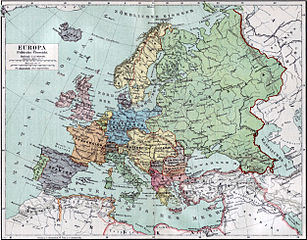
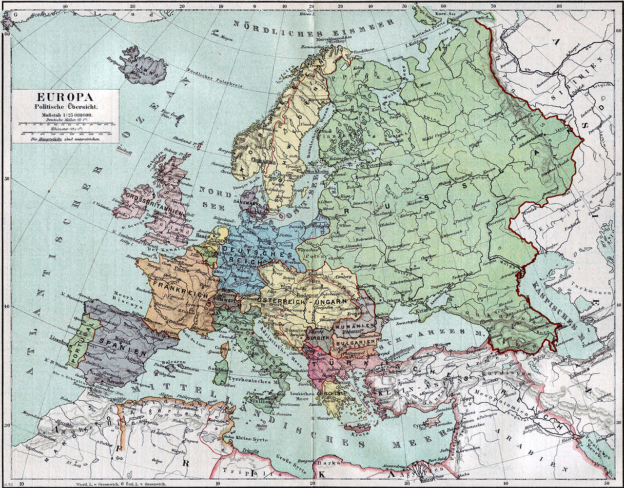
Politische Karte Europas ca. 1890 |
|||||
| Data | ||||||
| Fonte | Meyers Kleines Konversationslexikon. Fünfte, umgearbeitete und vermehrte Auflage. Bd. 1. Bibliographisches Institut, Leipzig und Wien 1892. | |||||
| Creatore |
unbekannt, scan by sidonius 15:36, 7 November 2006 (UTC) |
|||||
| Licenza (Riusare questo file) |
|
|||||
| Georeferencing | If inappropriate please set warp_status = skip to hide. | |||||
| Altre versioni | Opere derivate da questo file: Blank map of Europe 1890.svg |

_en.png)
.png)
.jpg)
Cronologia del file
Fare clic su un gruppo data/ora per vedere il file come si presentava nel momento indicato.
| Data/Ora | Miniatura | Dimensioni | Utente | Commento | |
|---|---|---|---|---|---|
| attuale | 17:36, 7 nov 2006 | | 2 500 × 1 956 (1,84 MB) | Sidonius | {{Information |Description=Politische Karte Europas ca. 1890 |Source=Meyers Kleines Konversationslexikon. Fünfte, umgearbeitete und vermehrte Auflage. Bd. 1. Bibliographisches Institut, Leipzig und Wien 1892. |Date=1892 |Author=unbekannt, |
Pagine che usano questo file
Le seguenti 3 pagine usano questo file:
Utilizzo globale del file
Anche i seguenti wiki usano questo file:
- Usato nelle seguenti pagine di bn.wikipedia.org:
- Usato nelle seguenti pagine di de.wikipedia.org:
- Usato nelle seguenti pagine di de.wikibooks.org:
- Usato nelle seguenti pagine di en.wikipedia.org:
- Usato nelle seguenti pagine di et.wikipedia.org:
- Usato nelle seguenti pagine di fa.wikipedia.org:
- Usato nelle seguenti pagine di fr.wikipedia.org:
- Usato nelle seguenti pagine di hu.wikipedia.org:
- Usato nelle seguenti pagine di mk.wikipedia.org:
- Usato nelle seguenti pagine di pl.wikipedia.org:
- Usato nelle seguenti pagine di pnb.wikipedia.org:
- Usato nelle seguenti pagine di sa.wikipedia.org:
- Usato nelle seguenti pagine di scn.wikipedia.org:
- Usato nelle seguenti pagine di skr.wikipedia.org:
- Usato nelle seguenti pagine di uk.wikipedia.org:
- Usato nelle seguenti pagine di ur.wikipedia.org: