File:Karte A Bgld OP.svg

Dimensioni di questa anteprima PNG per questo file SVG: 342 × 599 pixel. Altre risoluzioni: 137 × 240 pixel | 274 × 480 pixel | 439 × 768 pixel | 585 × 1 024 pixel | 1 170 × 2 048 pixel | 600 × 1 050 pixel.
File originale (file in formato SVG, dimensioni nominali 600 × 1 050 pixel, dimensione del file: 14 KB)
| Questo file e la sua pagina di descrizione (discussione · modifica) si trovano su Wikimedia Commons (?) |
Dettagli
| Descrizione |
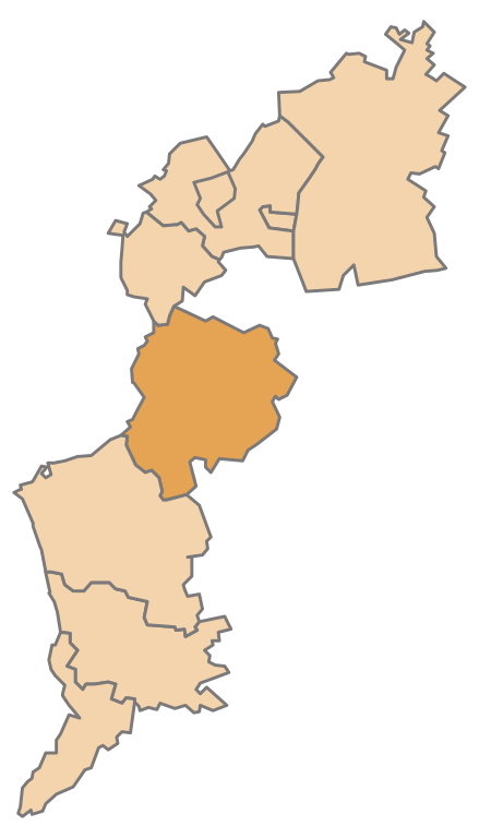
English: Map of the Austrian State Burgenland, highlighting Oberpullendorf
Deutsch: Karte des österreichischen Bundeslandes Burgenland, Oberpullendorf hervorgehoben |
| Data | |
| Fonte | Opera propria |
| Autore | AleXXw |
Licenza
| Io, detentore del copyright su quest'opera, la rilascio nel pubblico dominio. Questa norma si applica in tutto il mondo. In alcuni paesi questo potrebbe non essere legalmente possibile. In tal caso: Garantisco a chiunque il diritto di utilizzare quest'opera per qualsiasi scopo, senza alcuna condizione, a meno che tali condizioni siano richieste dalla legge. |
Cronologia del file
Fare clic su un gruppo data/ora per vedere il file come si presentava nel momento indicato.
| Data/Ora | Miniatura | Dimensioni | Utente | Commento | |
|---|---|---|---|---|---|
| attuale | 23:58, 12 mag 2009 | | 600 × 1 050 (14 KB) | AleXXw | == Beschreibung == {{Information |Description={{en|1=Map of the Austrian State Burgenland, highlighting Oberpullendorf}} {{de|1=Karte des österreichischen Bundeslandes Burgenland, Oberpullendorf hervorgehoben}} |Source=Eigenes Werk (own work) |Author=[[U |
Pagine che usano questo file
La seguente pagina usa questo file:
Utilizzo globale del file
Anche i seguenti wiki usano questo file:
- Usato nelle seguenti pagine di cs.wikipedia.org:
- Usato nelle seguenti pagine di de.wikipedia.org:
- Bezirk Oberpullendorf
- Oberloisdorf
- Vorlage:Navigationsleiste Städte und Gemeinden im Bezirk Oberpullendorf
- Deutschkreutz
- Draßmarkt
- Frankenau-Unterpullendorf
- Großwarasdorf
- Horitschon
- Kaisersdorf
- Kobersdorf
- Lackenbach
- Lockenhaus
- Lutzmannsburg
- Mannersdorf an der Rabnitz
- Lackendorf
- Unterfrauenhaid
- Raiding
- Markt Sankt Martin
- Neckenmarkt
- Nikitsch
- Pilgersdorf
- Piringsdorf
- Ritzing (Burgenland)
- Steinberg-Dörfl
- Stoob
- Weppersdorf
- Unterrabnitz-Schwendgraben
- Weingraben
- Neutal
- Liste der politischen Bezirke des Burgenlands
- Oberpullendorf
- Denkmalgeschützte Objekte im Bezirk Oberpullendorf
- Wikipedia:WikiProjekt Österreich/checks/Navis/Burgenland
- Usato nelle seguenti pagine di eo.wikipedia.org:
Visualizza l'utilizzo globale di questo file.