File:Delaware Basin map.PNG
Dimensioni di questa anteprima: 800 × 506 pixel. Altre risoluzioni: 320 × 202 pixel | 640 × 405 pixel | 1 160 × 734 pixel.
File originale (1 160 × 734 pixel, dimensione del file: 123 KB, tipo MIME: image/png)
| Questo file e la sua pagina di descrizione (discussione · modifica) si trovano su Wikimedia Commons (?) |
Dettagli
| Descrizione |
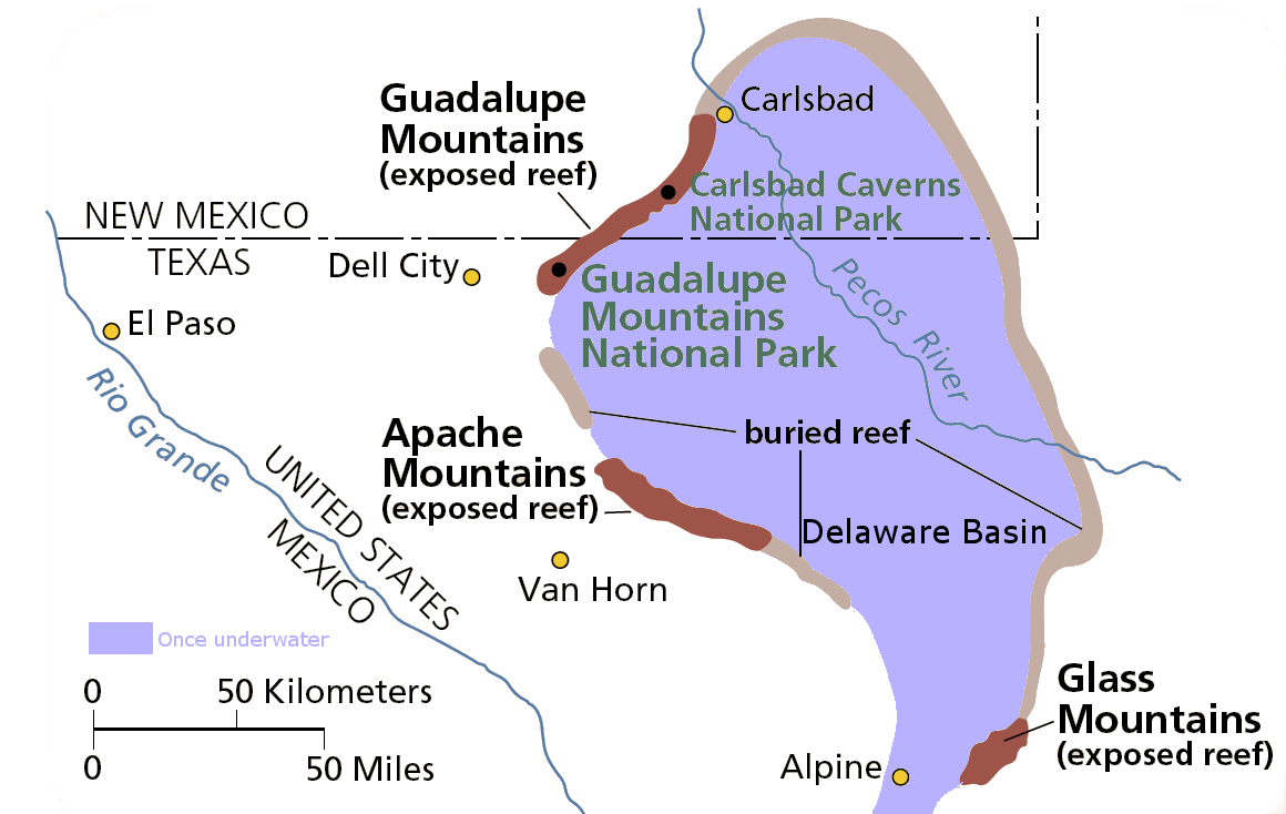
English: Map of the Delaware Basin — a geologic depositional and structural basin in West Texas and southeastern New Mexico.
|
| Data | Data sconosciuta |
| Fonte | Opera propria |
| Autore | National Park Service |
| Licenza (Riusare questo file) |
From pdf linked from http://www.nps.gov/gumo/naturescience/geologicformations.htm Edited using the GIMP. I place those edits in the public domain. |
Licenza
| This image or media file contains material based on a work of a National Park Service employee, created as part of that person's official duties. As a work of the U.S. federal government, such work is in the public domain in the United States. See the NPS website and NPS copyright policy for more information. |
Cronologia del file
Fare clic su un gruppo data/ora per vedere il file come si presentava nel momento indicato.
| Data/Ora | Miniatura | Dimensioni | Utente | Commento | |
|---|---|---|---|---|---|
| attuale | 04:39, 1 ago 2007 | | 1 160 × 734 (123 KB) | Mav | from pdf linked from http://www.nps.gov/gumo/naturescience/geologicformations.htm Edited using the GIMP. I place those edits in the public domain. |
Pagine che usano questo file
La seguente pagina usa questo file:
Utilizzo globale del file
Anche i seguenti wiki usano questo file:
- Usato nelle seguenti pagine di en.wikipedia.org:
- Usato nelle seguenti pagine di es.wikipedia.org:
- Usato nelle seguenti pagine di he.wikipedia.org:
- Usato nelle seguenti pagine di uk.wikipedia.org:
- Usato nelle seguenti pagine di www.wikidata.org: