File:Quadrangles of Dione (ed. 2011) - PIA12827.jpg
File originale (3 087 × 2 024 pixel, dimensione del file: 705 KB, tipo MIME: image/jpeg)
| Questo file e la sua pagina di descrizione (discussione · modifica) si trovano su Wikimedia Commons (?) |
_-_PIA12827.jpg?uselang=it)
_-_PIA12827.jpg)
_-_PIA12827.jpg&action=edit)
Dettagli
| Descrizione |
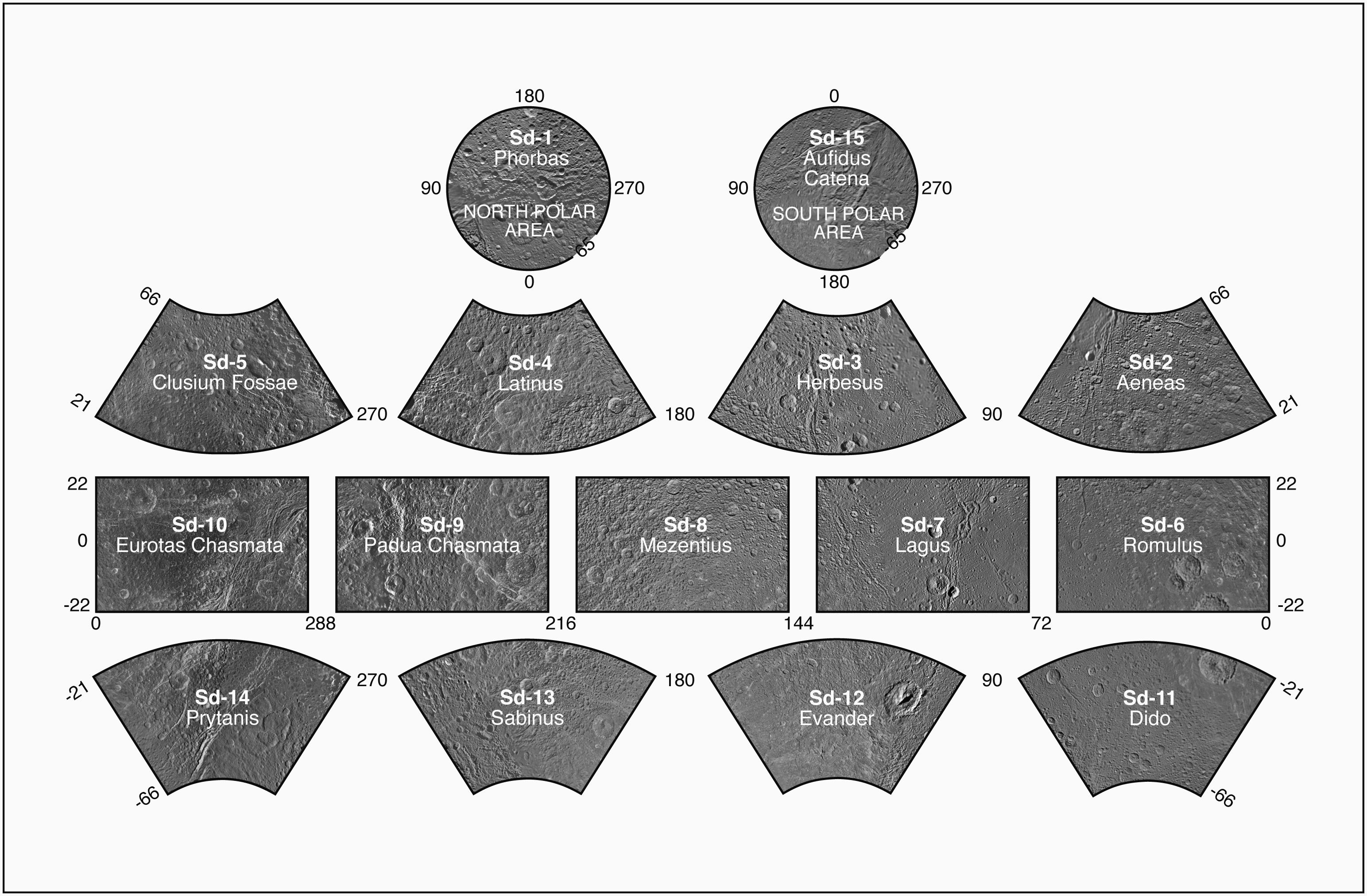
English: Presented here is a complete set of cartographic map sheets from a high-resolution Dione atlas, a project of the Cassini Imaging Team.
The map sheets form a 15-quadrangle series covering the entire surface of Dione at a nominal scale of 1:1,000,000. An index for the atlas is included here, along with an unlabeled version of each terrain section. The map data was acquired by the Cassini imaging experiment. The mean radius of Dione used for projection of the maps is 562.53 kilometers (349.54 miles). Names for features have been approved by the International Astronomical Union (IAU). This atlas is an update to the version released in August 2008 (see PIA08418). The Cassini Solstice Mission is a joint United States and European endeavor. The Jet Propulsion Laboratory, a division of the California Institute of Technology in Pasadena, manages the mission for NASA's Science Mission Directorate, Washington, D.C. The Cassini orbiter was designed, developed and assembled at JPL. The imaging team consists of scientists from the US, England, France, and Germany. The imaging operations center and team lead (Dr. C. Porco) are based at the Space Science Institute in Boulder, Colo. For more information about the Cassini Solstice Mission visit http://ciclops.org, http://www.nasa.gov/cassini and http://saturn.jpl.nasa.gov. Credit: NASA / JPL-Caltech / Space Science Institute Released: September 28, 2011 (PIA 12827) |
| Data | |
| Fonte | http://photojournal.jpl.nasa.gov/catalog/PIA12827 |
| Autore | NASA/JPL/Space Science Institute |
Licenza
| Questo file è nel pubblico dominio perché creato dalla NASA. La politica sul copyright della NASA afferma che «il materiale della NASA non è protetto da copyright a meno che non sia specificato altrimenti». (NASA copyright policy e JPL Image Use Policy). | ||
 |
Attenzione:
|
Cronologia del file
Fare clic su un gruppo data/ora per vedere il file come si presentava nel momento indicato.
| Data/Ora | Miniatura | Dimensioni | Utente | Commento | |
|---|---|---|---|---|---|
| attuale | 23:41, 14 gen 2016 | | 3 087 × 2 024 (705 KB) | Ysogo | Presented here is a complete set of cartographic map sheets from a high-resolution Dione atlas, a project of the Cassini Imaging Team. The map sheets form a 15-quadrangle series covering the entire surface of Dione at a nominal scale of 1:1,000,000. A... |
Pagine che usano questo file
La seguente pagina usa questo file:
Utilizzo globale del file
Anche i seguenti wiki usano questo file:
- Usato nelle seguenti pagine di ca.wikipedia.org:
_-_PIA12827.jpg)