File:Chièvres Hainaut Belgium Map.png
Non sono disponibili versioni a risoluzione più elevata.
Chièvres_Hainaut_Belgium_Map.png (355 × 278 pixel, dimensione del file: 8 KB, tipo MIME: image/png)
| Questo file e la sua pagina di descrizione (discussione · modifica) si trovano su Wikimedia Commons (?) |

|
File:Chièvres Hainaut Belgium Map.svg è una versione vettoriale di questo file. Dovrebbe essere usata quella versione al posto di questo file PNG, quando sia migliore.
File:Chièvres Hainaut Belgium Map.png → File:Chièvres Hainaut Belgium Map.svg
Per maggiori informazioni, vedi Help:SVG. |
 |
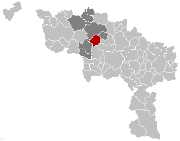
English: Map, municipality belgium Chièvres
Français : Carte indiquant la localisation de la commune de Chièvres dans la Province de Hainaut.
English: Map from w:nl:Gebruiker:LennartBolks/kaartenhoekje in Public Domain by the Author choice.
| Quest'opera è stata rilasciata nel pubblico dominio dal suo autore, LennartBolks. Questa norma si applica in tutto il mondo. In alcuni paesi questo potrebbe non essere legalmente possibile. In tal caso: |
Cronologia del file
Fare clic su un gruppo data/ora per vedere il file come si presentava nel momento indicato.
| Data/Ora | Miniatura | Dimensioni | Utente | Commento | |
|---|---|---|---|---|---|
| attuale | 15:12, 16 nov 2008 | | 355 × 278 (8 KB) | Wester | {{Information |Description= |Source= |Date= |Author= |Permission= |other_versions= }} |
| 19:34, 25 mag 2006 |  | 355 × 278 (8 KB) | Profoss | ||
| 23:36, 28 mar 2005 |  | 355 × 278 (6 KB) | Nicnac25~commonswiki | Map, municipality belgium Chièvres {{PD}} FR; Carte indiquant la localisation de la commune de Chièvres dans la Province de Hainaut. EN; Map from w:nl:Gebruiker:LennartBolks/kaartenhoekje in Public Domain by the Author choice. [[Category:Maps of pr |
Pagine che usano questo file
Nessuna pagina utilizza questo file.