File:Confluence of the Green and Yampa Rivers (17396238518).jpg
Dimensioni di questa anteprima: 800 × 533 pixel. Altre risoluzioni: 320 × 213 pixel | 640 × 427 pixel | 1 024 × 683 pixel | 1 280 × 853 pixel | 2 048 × 1 365 pixel.
File originale (2 048 × 1 365 pixel, dimensione del file: 589 KB, tipo MIME: image/jpeg)
| Questo file e la sua pagina di descrizione (discussione · modifica) si trovano su Wikimedia Commons (?) |
.jpg?uselang=it)
.jpg)
.jpg&action=edit)
Dettagli
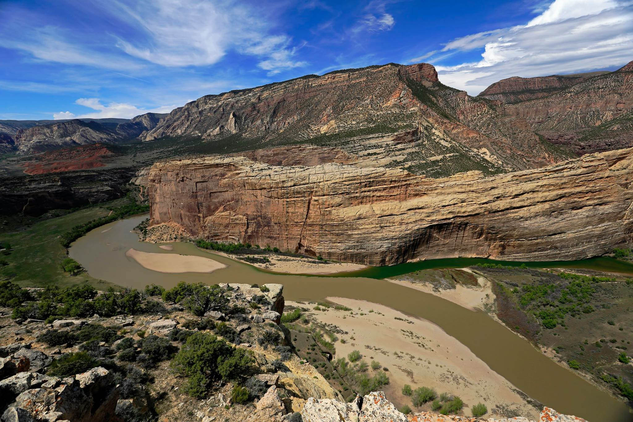
| Descrizione | Taken from the top of Jenny Lind Rock, this view shows the confluence of the Green and Yampa rivers at the base of Steamboat Rock in Echo Park. The rocky summit in the background is Harpers Corner. |
| Data | |
| Fonte | Confluence of the Green and Yampa Rivers |
| Autore | Dinosaur National Monument from USA |
| Luogo dello scatto | | Posizione di questa e altre immagini su: OpenStreetMap |
|---|
.jpg¶ms=040.526670_N_-108.979611_E_globe:Earth_type:camera_source:Flickr_&language=it)
Licenza
| This image or media file contains material based on a work of a National Park Service employee, created as part of that person's official duties. As a work of the U.S. federal government, such work is in the public domain in the United States. See the NPS website and NPS copyright policy for more information. |
Cronologia del file
Fare clic su un gruppo data/ora per vedere il file come si presentava nel momento indicato.
| Data/Ora | Miniatura | Dimensioni | Utente | Commento | |
|---|---|---|---|---|---|
| attuale | 21:36, 21 ott 2015 | | 2 048 × 1 365 (589 KB) | Holly Cheng | Transferred from Flickr via Flickr2Commons |
Pagine che usano questo file
La seguente pagina usa questo file:
Utilizzo globale del file
Anche i seguenti wiki usano questo file:
- Usato nelle seguenti pagine di de.wikipedia.org:
- Usato nelle seguenti pagine di en.wikipedia.org:
- Usato nelle seguenti pagine di fr.wikipedia.org:
- Usato nelle seguenti pagine di ja.wikipedia.org:
- Usato nelle seguenti pagine di no.wikipedia.org:
- Usato nelle seguenti pagine di pt.wikipedia.org:
- Usato nelle seguenti pagine di simple.wikipedia.org:
- Usato nelle seguenti pagine di zh.wikipedia.org:
.jpg)