File:Crater Lake National Park map.jpg

Dimensioni di questa anteprima: 526 × 600 pixel. Altre risoluzioni: 210 × 240 pixel | 421 × 480 pixel | 673 × 768 pixel | 898 × 1 024 pixel | 2 519 × 2 873 pixel.
File originale (2 519 × 2 873 pixel, dimensione del file: 1,37 MB, tipo MIME: image/jpeg)
| Questo file e la sua pagina di descrizione (discussione · modifica) si trovano su Wikimedia Commons (?) |
Dettagli
| Luogo dello scatto | | Posizione di questa e altre immagini su: OpenStreetMap |
|---|
| Descrizione |
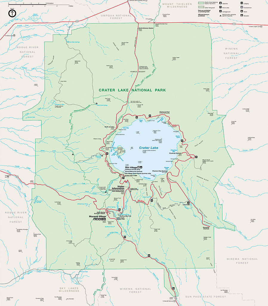
English: Map of Crater Lake National Park, Oregon, United States.
Français : Carte du parc national de Crater Lake, Oregon, États-Unis. |
| Data | (upload date) |
| Fonte | U.S. National Park Service |
| Autore | U.S. National Park Service, saved in JPG by user:Sting |
| Licenza (Riusare questo file) |
PD-USGOV-INTERIOR-NPS. |
| Altre versioni |
|


Licenza
| This image or media file contains material based on a work of a National Park Service employee, created as part of that person's official duties. As a work of the U.S. federal government, such work is in the public domain in the United States. See the NPS website and NPS copyright policy for more information. |
Cronologia del file
Fare clic su un gruppo data/ora per vedere il file come si presentava nel momento indicato.
| Data/Ora | Miniatura | Dimensioni | Utente | Commento | |
|---|---|---|---|---|---|
| attuale | 22:00, 14 ott 2009 | | 2 519 × 2 873 (1,37 MB) | Sting | {{Location|42|56|00|N|122|07|00|W|scale:200000}}<br/> {{Information |Description={{en|Map of Crater Lake National Park, Oregon, United States.}} {{fr|Carte du [[:fr:Parc national de Crater Lake|parc national de Crater Lak |
Pagine che usano questo file
La seguente pagina usa questo file:
Utilizzo globale del file
Anche i seguenti wiki usano questo file:
- Usato nelle seguenti pagine di de.wikipedia.org:
- Usato nelle seguenti pagine di fr.wikipedia.org:
- Usato nelle seguenti pagine di nl.wikipedia.org:
- Usato nelle seguenti pagine di pl.wikipedia.org: