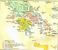
File:Greece in 1278.svg

Dimensioni di questa anteprima PNG per questo file SVG: 800 × 456 pixel. Altre risoluzioni: 320 × 182 pixel | 640 × 365 pixel | 1 024 × 584 pixel | 1 280 × 730 pixel | 2 560 × 1 460 pixel | 3 508 × 2 000 pixel.
File originale (file in formato SVG, dimensioni nominali 3 508 × 2 000 pixel, dimensione del file: 1 014 KB)
Cronologia del file
Fare clic su un gruppo data/ora per vedere il file come si presentava nel momento indicato.
| Data/Ora | Miniatura | Dimensioni | Utente | Commento | |
|---|---|---|---|---|---|
| attuale | 22:04, 23 giu 2017 |  | 3 508 × 2 000 (1 014 KB) | Cplakidas | fixed name |
| 14:14, 11 apr 2017 |  | 3 508 × 2 000 (1 017 KB) | Cplakidas | colour changes | |
| 20:22, 8 feb 2017 |  | 3 508 × 2 000 (1 018 KB) | Cplakidas | text to paths | |
| 20:11, 8 feb 2017 |  | 3 508 × 2 000 (1 002 KB) | Cplakidas | User created page with UploadWizard |
Pagine che usano questo file
Le seguenti 2 pagine usano questo file:
Utilizzo globale del file
Anche i seguenti wiki usano questo file:
- Usato nelle seguenti pagine di ar.wikipedia.org:
- Usato nelle seguenti pagine di az.wikipedia.org:
- Usato nelle seguenti pagine di bg.wikipedia.org:
- Usato nelle seguenti pagine di el.wikipedia.org:
- Usato nelle seguenti pagine di en.wikipedia.org:
- Fourth Crusade
- Principality of Achaea
- Patras
- Portal:Spain
- Battle of Halmyros
- History of Thessaly
- John I Doukas of Thessaly
- Nicholas III of Saint-Omer
- Nicholas II of Saint-Omer
- Matilda of Hainaut
- Boniface of Verona
- Battle of Neopatras
- Battle of Demetrias
- Lordship of Salona
- Jacopo Dondulo
- Byzantine–Venetian treaty of 1277
- Usato nelle seguenti pagine di es.wikipedia.org:
- Usato nelle seguenti pagine di et.wikipedia.org:
- Usato nelle seguenti pagine di fa.wikipedia.org:
- Usato nelle seguenti pagine di fr.wikipedia.org:
- Usato nelle seguenti pagine di hr.wikipedia.org:
- Usato nelle seguenti pagine di hyw.wikipedia.org:
- Usato nelle seguenti pagine di ka.wikipedia.org:
- Usato nelle seguenti pagine di pl.wikipedia.org:
- Usato nelle seguenti pagine di pt.wikipedia.org:
- Usato nelle seguenti pagine di ru.wikipedia.org:
- Usato nelle seguenti pagine di sq.wikipedia.org:
- Usato nelle seguenti pagine di sr.wikipedia.org:
- Usato nelle seguenti pagine di tr.wikipedia.org:
- Usato nelle seguenti pagine di uk.wikipedia.org:
Visualizza l'utilizzo globale di questo file.


