File:ISS-30 Lake Fitri, Chad.jpg
Dimensioni di questa anteprima: 800 × 531 pixel. Altre risoluzioni: 320 × 213 pixel | 640 × 425 pixel | 1 024 × 680 pixel | 1 280 × 850 pixel | 2 560 × 1 700 pixel | 4 288 × 2 848 pixel.
File originale (4 288 × 2 848 pixel, dimensione del file: 6,37 MB, tipo MIME: image/jpeg)
| Questo file e la sua pagina di descrizione (discussione · modifica) si trovano su Wikimedia Commons (?) |
Dettagli
| Descrizione |
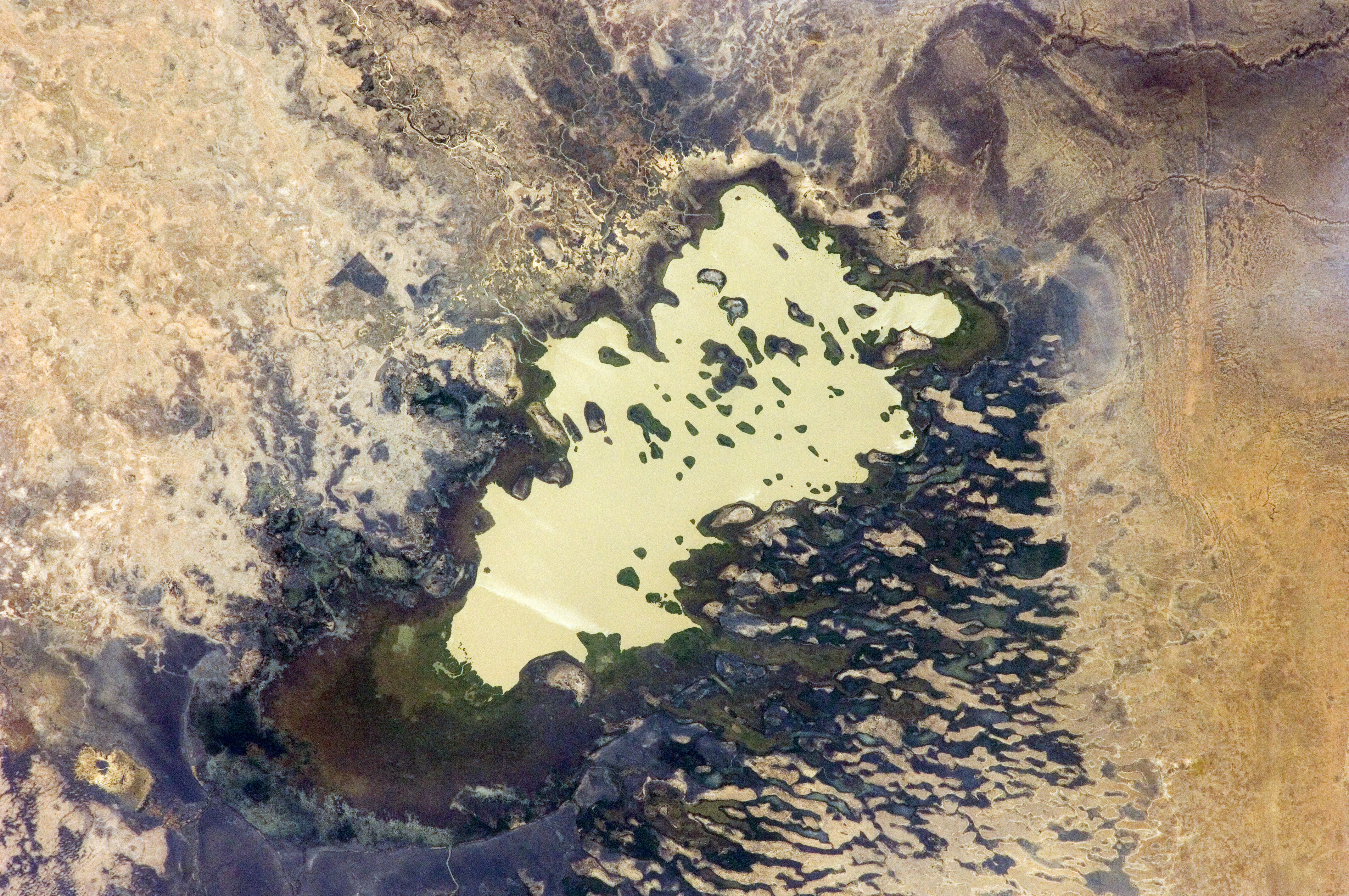
English: Lake Fitri, Chad is featured in this image photographed by an Expedition 30 crew member on the International Space Station.
|
| Data | |
| Fonte | http://spaceflight.nasa.gov/gallery/images/station/crew-30/html/iss030e059398.html |
| Autore | NASA |
Questa immagine o filmato è stato catalogato dal Johnson Space Center della National Aeronautics and Space Administration (NASA) degli Stati Uniti d'Americacon il Photo ID: ISS030-E-059398.Questo tag non indica lo status del copyright dell'opera ad esso associato. È quindi richiesto un normale tag di copyright. Vedi Commons:Licenze per maggiori informazioni. Altre lingue:
|
Licenza
"The Gateway to Astronaut Photography of Earth". Le immagini provengono dall'Image Science & Analysis Laboratory, della NASA Johnson Space Center.
Fonte della foto: ISS030-E-59398.
|
Cronologia del file
Fare clic su un gruppo data/ora per vedere il file come si presentava nel momento indicato.
| Data/Ora | Miniatura | Dimensioni | Utente | Commento | |
|---|---|---|---|---|---|
| attuale | 22:00, 20 apr 2016 | | 4 288 × 2 848 (6,37 MB) | Ras67 | new rendered in high quality from NASA's raw image data |
| 14:46, 4 giu 2012 |  | 4 288 × 2 848 (2,03 MB) | Ras67 | levels | |
| 19:59, 21 feb 2012 |  | 4 288 × 2 848 (1,76 MB) | Ras67 | {{Information |Description ={{en|1=Lake Fitri, Chad is featured in this image photographed by an Expedition 30 crew member on the International Space Station. Lake Fitri is an endorheic, or terminal lake in a desert basin in the southern Sahara Desert. |
Pagine che usano questo file
La seguente pagina usa questo file:
Utilizzo globale del file
Anche i seguenti wiki usano questo file:
- Usato nelle seguenti pagine di ar.wikipedia.org:
- Usato nelle seguenti pagine di arz.wikipedia.org:
- Usato nelle seguenti pagine di be.wikipedia.org:
- Usato nelle seguenti pagine di cv.wikipedia.org:
- Usato nelle seguenti pagine di de.wikipedia.org:
- Usato nelle seguenti pagine di el.wikipedia.org:
- Usato nelle seguenti pagine di en.wikipedia.org:
- Usato nelle seguenti pagine di es.wikipedia.org:
- Usato nelle seguenti pagine di fr.wikipedia.org:
- Usato nelle seguenti pagine di id.wikipedia.org:
- Usato nelle seguenti pagine di ka.wikipedia.org:
- Usato nelle seguenti pagine di lt.wikipedia.org:
- Usato nelle seguenti pagine di my.wikipedia.org:
- Usato nelle seguenti pagine di nl.wikipedia.org:
- Usato nelle seguenti pagine di pl.wikipedia.org:
- Usato nelle seguenti pagine di ru.wikipedia.org:
- Usato nelle seguenti pagine di uk.wikipedia.org:
- Usato nelle seguenti pagine di vi.wikipedia.org:
- Usato nelle seguenti pagine di www.wikidata.org: