File:Lake District National Park UK relief location map.png
Dimensioni di questa anteprima: 494 × 600 pixel. Altre risoluzioni: 198 × 240 pixel | 395 × 480 pixel | 632 × 768 pixel | 843 × 1 024 pixel | 2 001 × 2 430 pixel.
File originale (2 001 × 2 430 pixel, dimensione del file: 3,62 MB, tipo MIME: image/png)
| Questo file e la sua pagina di descrizione (discussione · modifica) si trovano su Wikimedia Commons (?) |
| Descrizione |
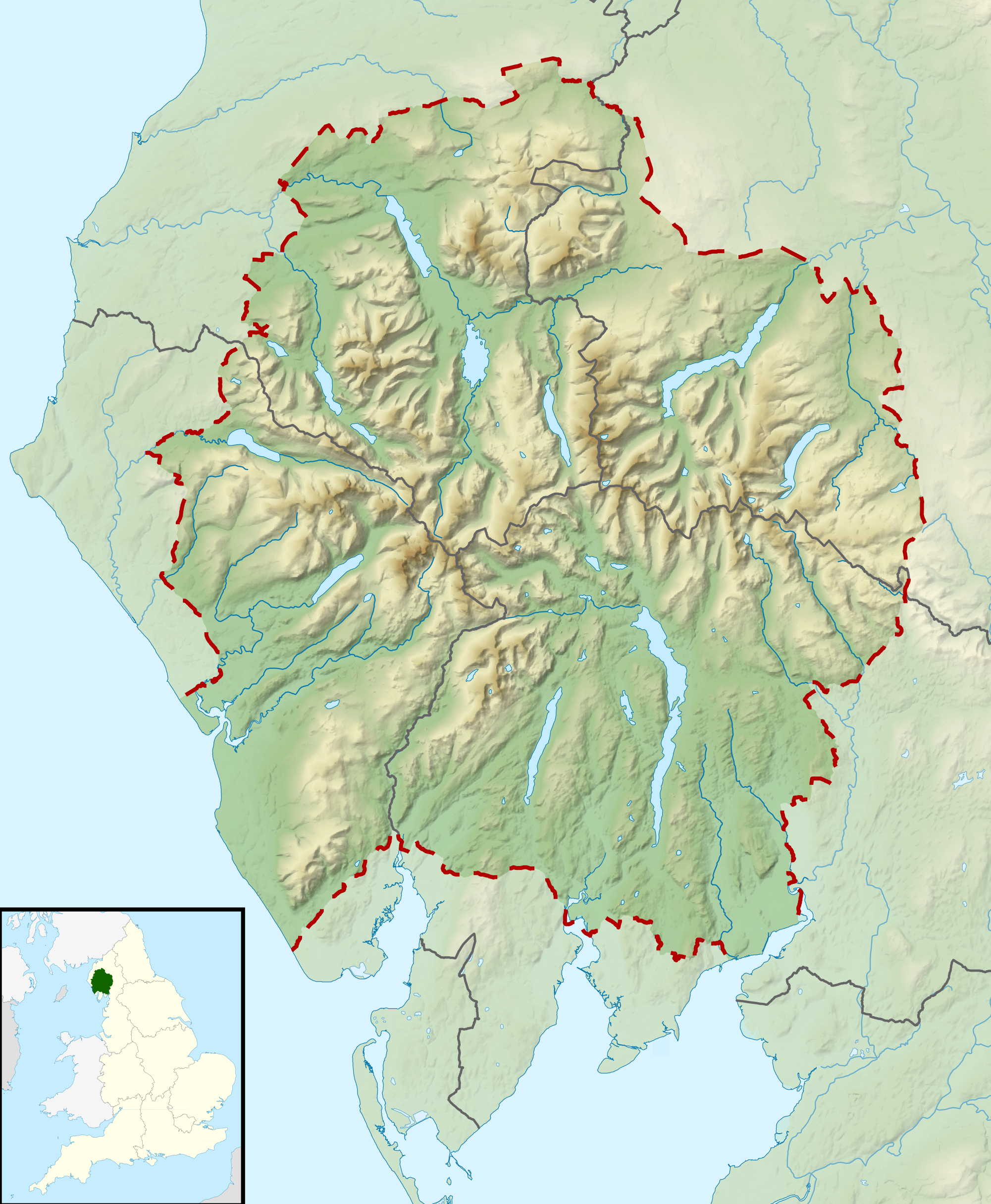
Relief map of the Lake District National Park, UK Equirectangular map projection on WGS 84 datum, with N/S stretched 170% Geographic limits:
|
| Data | |
| Fonte |
Office of National Statistics Geography
|
| Autore | Nilfanion, created using Ordnance Survey data |
| Licenza (Riusare questo file) |
Questo file è disponibile in base alla licenza Creative Commons Attribuzione-Condividi allo stesso modo 3.0 Unported Attribuzione: Contains Ordnance Survey data © Crown copyright and database right
|
Cronologia del file
Fare clic su un gruppo data/ora per vedere il file come si presentava nel momento indicato.
| Data/Ora | Miniatura | Dimensioni | Utente | Commento | |
|---|---|---|---|---|---|
| attuale | 12:51, 17 mar 2012 | | 2 001 × 2 430 (3,62 MB) | Nilfanion | {{Information |Description=Relief map of the Lake District National Park, UK Equirectangular map projection on WGS 84 datum, with N/S stretched 170% Geographic limits: *West: 3.65W *East: 2.60W *North: 54.80N *South: 54.05N |Sourc... |
Pagine che usano questo file
Le seguenti 11 pagine usano questo file:
Utilizzo globale del file
Anche i seguenti wiki usano questo file:
- Usato nelle seguenti pagine di ar.wikipedia.org:
- Usato nelle seguenti pagine di ceb.wikipedia.org:
- Usato nelle seguenti pagine di de.wikivoyage.org:
- Usato nelle seguenti pagine di en.wikipedia.org:
- Lake District
- Derwentwater
- Scafell Pike
- Windermere
- Coniston Water
- Scafell
- Helvellyn
- Wast Water
- Thirlmere
- Skiddaw
- List of lakes of the Lake District
- Bassenthwaite Lake
- Ullswater
- Buttermere
- Old Man of Coniston
- Dent (fell)
- Pillar (Lake District)
- Great Gable
- Bowfell
- Fairfield (Lake District)
- Great End
- Catstye Cam
- Blencathra
- Skiddaw Little Man
- Crinkle Crags
- Haweswater Reservoir
- Ennerdale Water
- Castlerigg stone circle
- Hard Knott
- Harter Fell (Eskdale)
- Whitbarrow
- Great Dodd
- High Street (Lake District)
- Pavey Ark
- Dale Head
- Robinson (Lake District)
- Place Fell
- Little Mell Fell
- Grayrigg Forest
- Hallin Fell
- Grasmoor
- Cold Pike
- Gummer's How
- Whitfell
- High Raise (Langdale)
- Kirkby Moor
- Cat Bells
Visualizza l'utilizzo globale di questo file.