File:Liverpool Bay.png

Dimensioni di questa anteprima: 800 × 593 pixel. Altre risoluzioni: 320 × 237 pixel | 640 × 474 pixel | 1 024 × 759 pixel | 1 278 × 947 pixel.
File originale (1 278 × 947 pixel, dimensione del file: 1,84 MB, tipo MIME: image/png)
| Questo file e la sua pagina di descrizione (discussione · modifica) si trovano su Wikimedia Commons (?) |
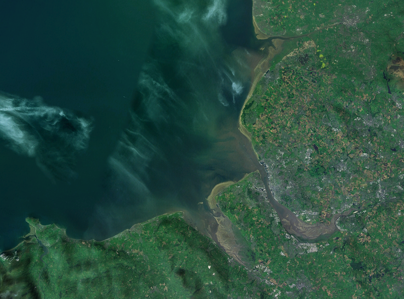
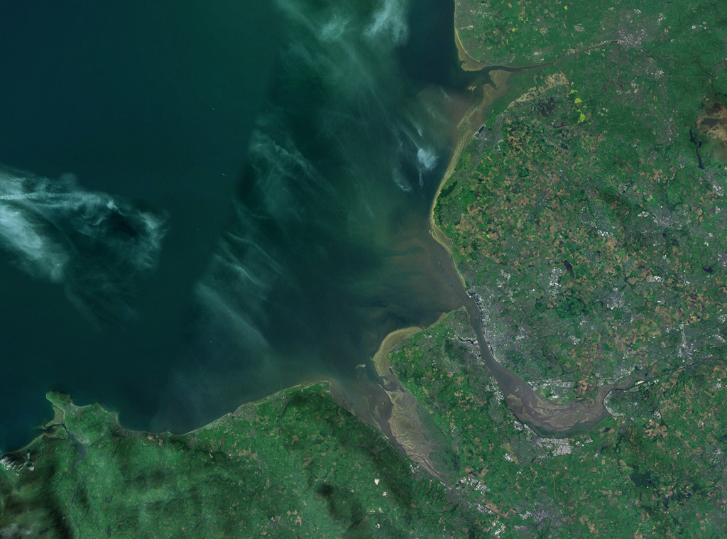
| Descrizione | A satellite photograph of Liverpool Bay, showing the West Lancashire Coastal Plain River Ribble at the top (north), the River Alt (hardly visble), River Mersey (centre) River Dee and the River Conwy in the south west. |
| Data | |
| Fonte | NASA World Wind - Landsat 7 |
| Autore | Smurrayinchester |
| This image is in the public domain because it is a screenshot from NASA’s globe software World Wind using a public domain layer, such as Blue Marble, MODIS, Landsat, SRTM, USGS or GLOBE.
|
 |
| Luogo dello scatto | | Posizione di questa e altre immagini su: OpenStreetMap |
|---|

Cronologia del file
Fare clic su un gruppo data/ora per vedere il file come si presentava nel momento indicato.
| Data/Ora | Miniatura | Dimensioni | Utente | Commento | |
|---|---|---|---|---|---|
| attuale | 16:06, 28 apr 2007 | | 1 278 × 947 (1,84 MB) | Smurrayinchester | {{Information |Description=A satellite photograph of w:Liverpool Bay, showing the Rivers Dee and Mersey (centre), the River Alt (north) and the River Conwy (west). |Source=NASA World Wind - Landsat 7 |Date=28 April 2007 |Author= [[User:Smurrayincheste |
Pagine che usano questo file
La seguente pagina usa questo file:
Utilizzo globale del file
Anche i seguenti wiki usano questo file:
- Usato nelle seguenti pagine di ca.wikipedia.org:
- Usato nelle seguenti pagine di ceb.wikipedia.org:
- Usato nelle seguenti pagine di cy.wikipedia.org:
- Usato nelle seguenti pagine di en.wikipedia.org:
- Usato nelle seguenti pagine di eo.wikipedia.org:
- Usato nelle seguenti pagine di es.wikipedia.org:
- Usato nelle seguenti pagine di et.wikipedia.org:
- Usato nelle seguenti pagine di nl.wikipedia.org:
- Usato nelle seguenti pagine di nn.wikipedia.org:
- Usato nelle seguenti pagine di no.wikipedia.org:
- Usato nelle seguenti pagine di pl.wikipedia.org:
- Usato nelle seguenti pagine di pl.wiktionary.org:
- Usato nelle seguenti pagine di ru.wikipedia.org:
- Usato nelle seguenti pagine di sr.wikipedia.org:
- Usato nelle seguenti pagine di sv.wikipedia.org:
- Usato nelle seguenti pagine di vi.wikipedia.org:
- Usato nelle seguenti pagine di www.wikidata.org: