File:Map of the Second Madagascar Expedition.jpg
File originale (924 × 1 563 pixel, dimensione del file: 282 KB, tipo MIME: image/jpeg)
| Questo file e la sua pagina di descrizione (discussione · modifica) si trovano su Wikimedia Commons (?) |
Dettagli
| Descrizione |
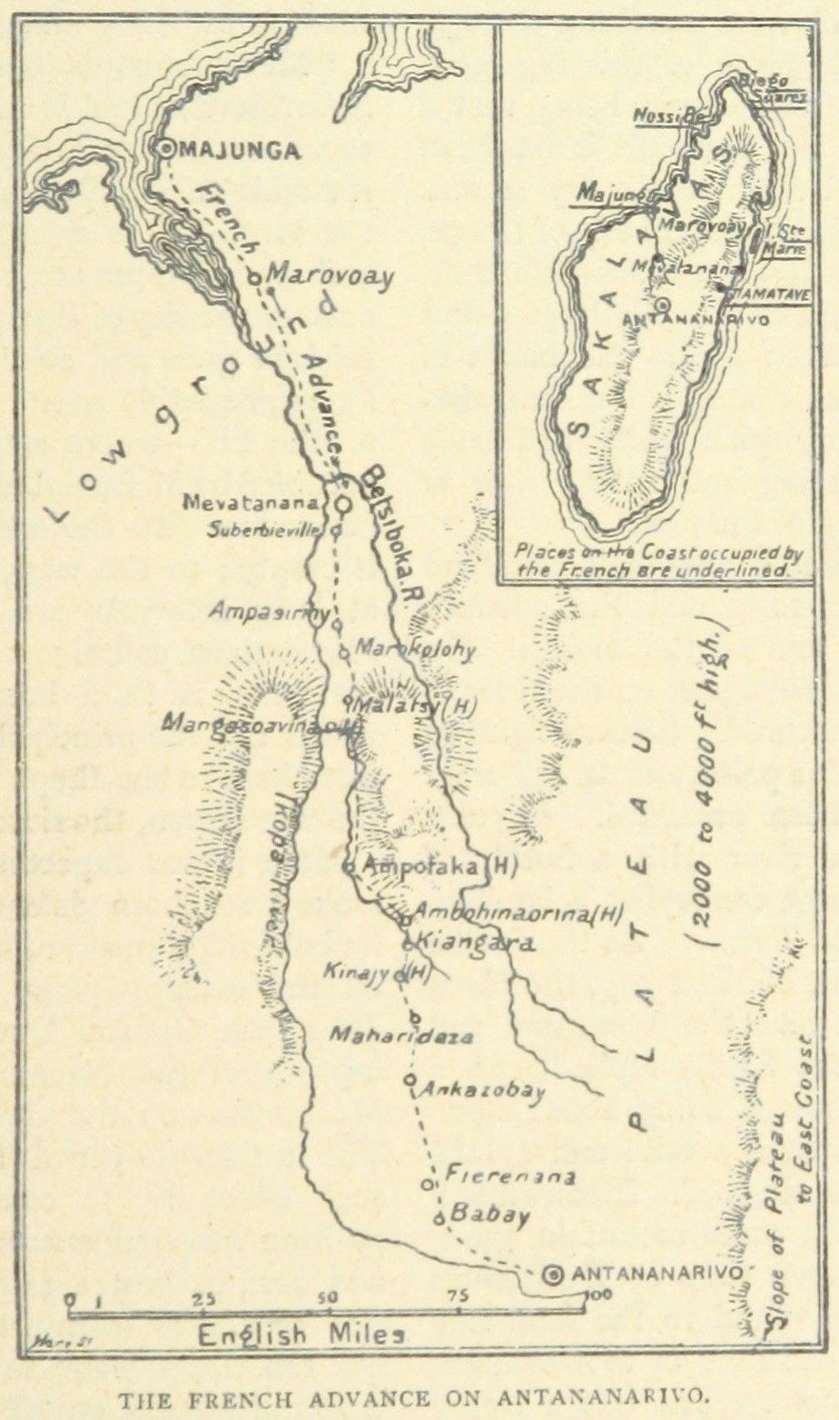
English: The French route during the Second Madagascar expedition. A second caption in the original text read "Note-The places marked thus (H) are fortified villages on the road from Mevatanana to the capital". |
||
| Data | |||
| Fonte |
From page 787of the 1899 book 'The Wars of the 'Nineties. A history of the warfare of the last ten years of the nineteenth century ... With ... illustrations ... and plans by the author'. Uploaded by the British Library to Flickr here. Cropped.
|
||
| Autore | Andrew Hilliard Atteridge |

Licenza
|
Quest'opera è nel pubblico dominio anche in tutti i Paesi e nelle aree in cui la durata del copyright è la vita dell'autore più 70 anni o meno. Quest'opera è nel pubblico dominio negli Stati Uniti in quanto pubblicata (o registrata all'U.S. Copyright Office) prima del 1º gennaio 1929. | |
| Questo file è stato identificato come libero da restrizioni conosciute riguardanti le leggi sul copyright, compresi tutti i diritti connessi e vicini. | |
Cronologia del file
Fare clic su un gruppo data/ora per vedere il file come si presentava nel momento indicato.
| Data/Ora | Miniatura | Dimensioni | Utente | Commento | |
|---|---|---|---|---|---|
| attuale | 05:58, 10 mar 2016 | | 924 × 1 563 (282 KB) | Howicus | User created page with UploadWizard |
Pagine che usano questo file
La seguente pagina usa questo file:
Utilizzo globale del file
Anche i seguenti wiki usano questo file:
- Usato nelle seguenti pagine di en.wikipedia.org:
- Usato nelle seguenti pagine di fr.wikipedia.org:
- Usato nelle seguenti pagine di uk.wikipedia.org: