File:Moll - The north part of Great Britain called Scotland.png

File originale (2 144 × 1 224 pixel, dimensione del file: 3,6 MB, tipo MIME: image/png)
| Questo file e la sua pagina di descrizione (discussione · modifica) si trovano su Wikimedia Commons (?) |
Dettagli
| Descrizione |
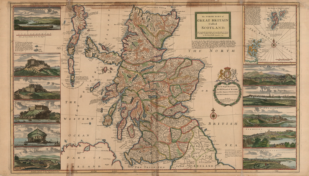
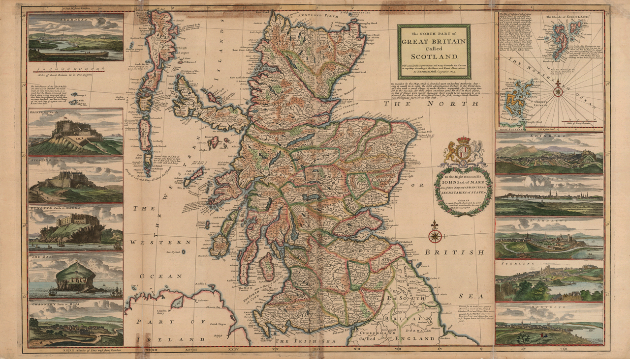
English: A c. 1714 map of Scotland with inset map of the Orkneys and Shetland Islands, many notes on the commercial fishing areas, and illustrations along the side taken from Jacobite broadsheets: Edinburgh, Edinburgh Castle, Stirling, Stirling Castle, Glasgow, Aberdeen, Montrose, Fortrose ("Channery"), St Andrews, Dunnottar Castle, and Bass Rock Castle.
|
|||||||||||||||||||||||
| Data | reprint of a 1714 map | |||||||||||||||||||||||
| Fonte | None provided or needed | |||||||||||||||||||||||
| Autore |
|
|||||||||||||||||||||||
| Altre versioni |
|
|||||||||||||||||||||||


.jpg)

Licenza
|
Quest'opera è nel pubblico dominio anche in tutti i Paesi e nelle aree in cui la durata del copyright è la vita dell'autore più 100 anni o meno. | |
| Questo file è stato identificato come libero da restrizioni conosciute riguardanti le leggi sul copyright, compresi tutti i diritti connessi e vicini. | |
| Annotazioni | Questa immagine è annotata: Vedi le annotazioni su Commons |
Cronologia del file
Fare clic su un gruppo data/ora per vedere il file come si presentava nel momento indicato.
| Data/Ora | Miniatura | Dimensioni | Utente | Commento | |
|---|---|---|---|---|---|
| attuale | 12:50, 16 set 2005 | | 2 144 × 1 224 (3,6 MB) | Frank Schulenburg | Herman Moll: ''The north part of Great Britain called Scotland: with considerable inprovements and many remarks not extant in any map'', c.1726 (originally published 1714) {{Creator:Herman Moll}} Category:18th century maps |
Pagine che usano questo file
La seguente pagina usa questo file:
Utilizzo globale del file
Anche i seguenti wiki usano questo file:
- Usato nelle seguenti pagine di en.wikipedia.org:
- Usato nelle seguenti pagine di es.wikipedia.org:
- Usato nelle seguenti pagine di pt.wikipedia.org: