File:Süleymaniye Mosque (8393803091).jpg
File originale (4 288 × 2 848 pixel, dimensione del file: 4,09 MB, tipo MIME: image/jpeg)
| Questo file e la sua pagina di descrizione (discussione · modifica) si trovano su Wikimedia Commons (?) |
.jpg?uselang=it)
.jpg)
.jpg&action=edit)
Dettagli
| Descrizione |
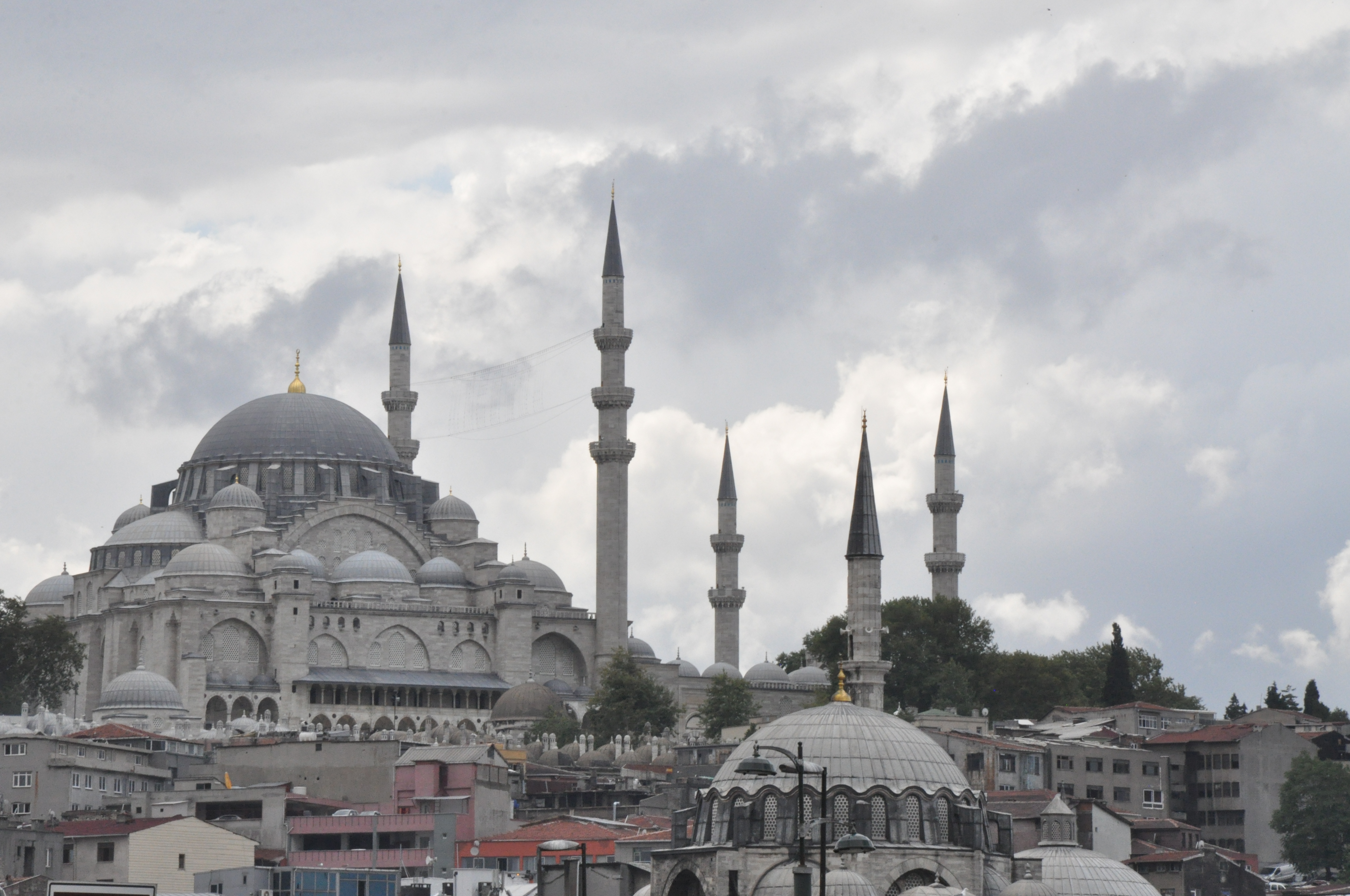
The Süleymaniye Mosque (Turkish: Süleymaniye Camii, Turkish pronunciation: [sylejˈmaːnije]) is an Ottoman imperial mosque located on the Third Hill of Istanbul, Turkey. It is the largest mosque in the city, and one of the best-known sights of Istanbul. ARCHITECTURE Exterior As with other imperial mosques in Istanbul, the mosque itself is preceded by a monumental courtyard (avlu) on its west side. The courtyard at the Süleymaniye is of exceptional grandeur with a colonnaded peristyle with columns of marble, granite and porphyry. At the four corners of the courtyard are the four minarets, a number only allowable to mosques endowed by a sultan (princes and princesses could construct two minarets; others only one). The minarets have a total of 10 galleries (serifes), which by tradition indicates that Suleiman I was the 10th Ottoman sultan. The main dome is 53 meters high and has a diameter of 27.5 meters. At the time it was built, the dome was the highest in the Ottoman Empire, when measured from sea level, but still lower from its base and smaller in diameter than that of Hagia Sophia. Interior Interior of the Süleymaniye. The interior of the mosque is almost a square, 59 meters in length and 58 meters in width, forming a single vast space. The dome is flanked by semi-domes, and to the north and south arches with tympana-filled windows, supported by enormous porphyry monoliths. Sinan decided to make a radical architectural innovation to mask the huge north-south buttresses needed to support these central piers. He incorporated the buttresses into the walls of the building, with half projecting inside and half projecting outside, and then hid the projections by building colonnaded galleries. There is a single gallery inside the structure, and a two-story gallery outside. The interior decoration is subtle, with very restrained use of Iznik tiles. The white marble mihrab and mimbar are also simple in design, and woodwork is restrained, with simple designs in ivory and mother of pearl. Complex As with other imperial mosques in Istanbul, the Süleymaniye Mosque was designed as a külliye, or complex with adjacent structures to service both religious and cultural needs. The original complex consisted of the mosque itself, a hospital (darüşşifa), primary school, public baths (hamam), a Caravanserai, four Qur'an schools (medrese), a specialized school for the learning of hadith, a medical college, and a public kitchen (imaret) which served food to the poor. Many of these structures are still in existence, and the former imaret is now a noted restaurant. The former hospital is now a printing factory owned by the Turkish Army. In the garden behind the main mosque there are two mausoleums (türbe) including the tombs of sultan Suleiman I, his wife Roxelana (Haseki Hürrem), his daughter Mihrimah, his mother Dilaşub Saliha and his sister Asiye. The sultans Suleiman II, Ahmed II and Safiye (died in 1777), the daughter of Mustafa II, are also buried here. Just outside the mosque walls, to the north is the tomb of architect Sinan [Wikipedia.org] |
| Data | |
| Fonte | Süleymaniye Mosque |
| Autore | Jorge Láscar from Australia |
| Luogo dello scatto | | Posizione di questa e altre immagini su: OpenStreetMap |
|---|
.jpg¶ms=041.016111_N_0028.963889_E_globe:Earth_type:camera_source:Flickr_&language=it)
Licenza
- Tu sei libero:
- di condividere – di copiare, distribuire e trasmettere quest'opera
- di modificare – di adattare l'opera
- Alle seguenti condizioni:
- attribuzione – Devi fornire i crediti appropriati, un collegamento alla licenza e indicare se sono state apportate modifiche. Puoi farlo in qualsiasi modo ragionevole, ma non in alcun modo che suggerisca che il licenziante approvi te o il tuo uso.
| Questa immagine è stata originariamente caricata su Flickr da Jorge Lascar all'indirizzo https://www.flickr.com/photos/8721758@N06/8393803091. È stata controllata in data 2 aprile 2014 dal robot FlickreviewR ed è stato confermato il suo rilascio sotto i termini della licenza cc-by-2.0. |
Cronologia del file
Fare clic su un gruppo data/ora per vedere il file come si presentava nel momento indicato.
| Data/Ora | Miniatura | Dimensioni | Utente | Commento | |
|---|---|---|---|---|---|
| attuale | 08:42, 2 apr 2014 | | 4 288 × 2 848 (4,09 MB) | Russavia | Transferred from Flickr |
Pagine che usano questo file
La seguente pagina usa questo file:
Utilizzo globale del file
Anche i seguenti wiki usano questo file:
- Usato nelle seguenti pagine di de.wikipedia.org:
- Usato nelle seguenti pagine di en.wikipedia.org:
- Usato nelle seguenti pagine di ha.wikipedia.org:
- Usato nelle seguenti pagine di ru.wikipedia.org:
.jpg)