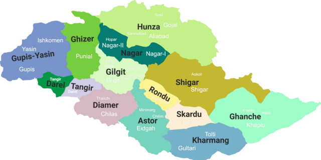
File:Gilgit-Baltistan map with tehsils labelled.png

Dimensioni di questa anteprima: 800 × 399 pixel. Altre risoluzioni: 320 × 160 pixel | 640 × 319 pixel | 1 024 × 511 pixel | 1 280 × 639 pixel | 2 560 × 1 278 pixel | 8 058 × 4 022 pixel.
File originale (8 058 × 4 022 pixel, dimensione del file: 1,47 MB, tipo MIME: image/png)
| Questo file e la sua pagina di descrizione (discussione · modifica) si trovano su Wikimedia Commons (?) |
Dettagli
| Descrizione |
English: Gilgit-Baltistan map with tehsils labelled |
| Data | (updated 2019) |
| Fonte | Opera propria |
| Autore | Kazmi |
Licenza
Io, detentore del copyright su quest'opera, dichiaro di pubblicarla con la seguente licenza:
Questo file è disponibile in base alla licenza Creative Commons Attribuzione-Condividi allo stesso modo 4.0 Internazionale
- Tu sei libero:
- di condividere – di copiare, distribuire e trasmettere quest'opera
- di modificare – di adattare l'opera
- Alle seguenti condizioni:
- attribuzione – Devi fornire i crediti appropriati, un collegamento alla licenza e indicare se sono state apportate modifiche. Puoi farlo in qualsiasi modo ragionevole, ma non in alcun modo che suggerisca che il licenziante approvi te o il tuo uso.
- condividi allo stesso modo – Se remixi, trasformi o sviluppi il materiale, devi distribuire i tuoi contributi in base alla stessa licenza o compatibile all'originale.
Cronologia del file
Fare clic su un gruppo data/ora per vedere il file come si presentava nel momento indicato.
| Data/Ora | Miniatura | Dimensioni | Utente | Commento | |
|---|---|---|---|---|---|
| attuale | 12:14, 19 giu 2019 | | 8 058 × 4 022 (1,47 MB) | Kazmi | Added missing details - district Tangir and Darel - Added names of main localities |
| 03:19, 19 giu 2019 |  | 8 058 × 4 022 (1,36 MB) | Kazmi | Added names and redefined the boundaries of newly established districts | |
| 03:50, 28 giu 2017 |  | 1 952 × 997 (80 KB) | Kazmi | User created page with UploadWizard |
Pagine che usano questo file
Le seguenti 3 pagine usano questo file:
Utilizzo globale del file
Anche i seguenti wiki usano questo file:
- Usato nelle seguenti pagine di bn.wikipedia.org:
- Usato nelle seguenti pagine di en.wikipedia.org:
- Masherbrum
- Kanjut Sar
- Haramosh Peak
- Distaghil Sar
- Chogolisa
- Districts of Pakistan
- Zarabod
- Sust
- Gilgit Agency
- Gasherbrum III
- Gasherbrum IV
- Baintha Brakk
- Hispar Muztagh
- Batbaykor
- Diran
- Kunyang Chhish
- Shispare
- Batura Sar
- Malubiting
- K6 (mountain)
- Shigar River
- Astore Wildlife Sanctuary
- Baltistan Wildlife Sanctuary
- Laila Peak (Haramosh Valley)
- Laila Peak (Rupal Valley)
- Passu Sar
- Taghafari
- Snow Dome, Concordia
- Rakaposhi-Haramosh Mountains
- Askole
- Panmah Muztagh
- Hispar Glacier
- Astore Valley
- Ghanche District
- Skardu District
- Gilgit District
- Diamer District
Visualizza l'utilizzo globale di questo file.